In case any of you would like to come along, I’m hiking a series of high routes in the Sierra Nevada August and September of 2017.
You can read more at katherinerosecook.com. Happy trails!
In case any of you would like to come along, I’m hiking a series of high routes in the Sierra Nevada August and September of 2017.
You can read more at katherinerosecook.com. Happy trails!
I flew home yesterday. Dan picked me up from the airport. I leaped into his arms. Home looms, and folds me back in right away. I cuddled my goat. I slept in my bed and dreamed I was hiking, and in the dream being home was a dream that I had to wake up from so I could finish the trail. What a trail!
Thank you all for reading! For commenting! I can’t tell you how much it means to me to have your eyes, your thoughts, your time. I want to apologize for all the typos. The autocorrect function on my phone is like a rabid, yappy little dog, very busy and sure of itself. Blogging on a smart phone from the trail is like putting zeroth drafts out into the world, so for your patience with that I am very grateful.
I’ll be posting some afterthoughts here in coming weeks, but mostly the blog will dwindle into artifact from here. If you have any questions or thoughts or comments, feel free to post them or contact me. And thank you!

Though not technically part of the Hayduke Trail, these two days were extensions of my adventure. I include them because they are like capstones.
First, drying out in a motel in Springdale was so wonderfully stabilizing. I left the next morning showered and laundered and with most of the mud knocked free. My plan was to spend the day hiking in the park. There is a very convenient shuttle system I could ride up to the trailheads I was interested in, and at the end of the day I would go to one of the park campgrounds and try to bum a tent site from an RV. I woke up achingly tired though, fatigue of many layers all into my bones, and I didn’t want to get up early and hurry. I lazed a bit. I had breakfast. I packed. Finally around 11am I left the motel to go catch the shuttle. What I didn’t consider, what never even occurred to me, is Memorial Day Weekend. Bumper-kissing cars inched down the road through town trying to get to the park Visitor Center (where surely they would be turned away because there wouldn’t be any parking). The sidewalks swarmed with people, and the Springdale shuttle buses were packed. I got on one and sat uncomfortably underneath my pack in a press of people, but the bus moved so slowly in the nearly-stopped traffic that I got right back off and walked into the Visitor Center instead. I needed to pick up my permit for the Subway first, where the ranger strongly advised me to bring a wetsuit. After the permit, I went to get on the park shuttle which drives up the main park road, but there was a line over a tenth of a mile long, and a half hour wait to even get on one of the buses. It was pandemonium. It was Disneyland. It hurt. I couldn’t even try to wait in line for thirty minutes to go hike in a park that was no doubt practically under assault by people. Originally I had hoped to hike during the day and go rent the equipment I would need for the Subway in the evening, but I decided to go back into town and rent stuff while the park was still busy and see if it opened up by the late afternoon.
I went to an outfitter, the only one in town I could find that would rent ropes, and picked up a seventy foot length of climbing rope, a harness, and an ATC. I also got one quick link in case I needed it and a pair of neoprene booties. I declined a full wetsuit. The guy at the outfitters didn’t think I would need one either, and I’ve been lied to by so many rangers about the dangers of my destination that I don’t ever believe them outright anymore. (They are speaking to a different part of the bell curve.) I went back through town and bought a dry bag, got a burger, went to the store, and by the time I was heading back to the Visitor Center it was close to four. The shuttle line was gone. I hopped on a bus. Time to hike!
I rode the shuttle all the way to the end of the road. The Narrows, a part of the North Fork of the Virgin River, started there on a paved trail. Other than the Subway, it was the hike I was most interested in in the park. I had applied for a permit for the top-down day hike in the lottery system but was denied, which ultimately didn’t matter because the road to the top of the Narrows hike was impassable due to all the rain. So I thought I would go bottom up, and still have a good time of it. But when I got off the shuttle at the last stop, there were people everywhere. I started walking down the trail in a line of people so thick I felt like I was on a Manhattan sidewalk. People hopped the rails of the trail, crushed vegetation, fed and tried to pet squirrels, were loud and obnoxious and I made it three quarters of a mile down the trail before I though fuck this. I turned around and walked back out, got back on the shuttle, and got the hell out of there. I have never seen such chaos in a national park. I hope never to again. Let me add my voice to those clamoring for more wilderness, more protection, more designation. At a time when our wild places are under greater threat than ever before, diminishing rapidly and permanently to development and resource extraction, the remaining scraps are in greater demand than ever. I can’t see how Zion can bear the force of this much humanity. Not that Zion is a scrap, of course. The flat-topped giant-walled rock buttes here practically stare down your soul. I think I understand why all the people come, assuming they are coming for that.
I bummed a campsite easily and hung out with my host, a full-time trailer-living nomad. We chatted as the campground hummed around us. I went to bed early.
The next day I packed everything inside the dry bag in my backpack and went to meet the private shuttle I was riding to the trailhead. I was expecting it to be full, particularly with other people doing the Subway top-down, but there was only one other passenger and he was headed for a different trailhead. Maybe I would have the Subway to myself. I was dropped off at the Wildcat Trailhead, right near where I hiked through on my last day. It was completely socked in then so I hadn’t known the splendor of the views in that area of the park. It was so lovely, cold and still wet there, and the morning sun was dense golden light spilled across the landscape. I hiked quickly to stay warm, on a trail for a mile and then descending a cairned route across a slickrock bowl in Russel’s Gulch, whose water course eventually drained into the Left Fork (the canyon of the Subway). The slickrock route eventually came to an end at a cliff where I dropped into the canyon on a steep but stable and blocky trail. And there I was, standing next to the creek, towering walls above me. It was full of lush growth, full of shadow, full of damp. I started downstream. Initially I tried to keep my feet dry but gave up when it was obviously doomed to fail, and I crossed or walked in the creek freely. Before long I came to the first rappel, down a twenty foot boulder choking up the canyon. The anchor was there, two bolts, a sling in good condition, and a quick link. I could have lowered my pack and downclimbed the boulder fairly easily, but I hauled the equipment all the way down there. I figured I might as well use it. I harnessed up, set the rope, and rapped down easily. This was the first time I had rappelled with such a heavy pack. Not that my pack was so heavy at that point, with little water and food, though still I had my entire backpack and all my stuff with me. But it was inconsequential. The rappel was short and and straightforward. On the ground I packed the rope back into my pack but I left the harness on and continued down canyon.
Soon the walls narrowed and potholes carved into the rock trapped water into pools. I got around the first couple without swimming. Then I had to swim. There was a pool thirty feet long, dark water obscuring the bottom. I stripped down to my underwear to have something dry to put on after, already feeling the chill of the canyon shade. I had a brief moment of WTF!? How am I going to swim this with my heavy pack?! But once I slipped into the water the secondary benefit of the dry bag in my backpack was immediately evident when my bag just floated there right next to me in the water. The water was painfully, shockingly cold. Not so cold it seared the skin, but the kind of cold that instantly starts feeding into your bones. I made the swim as quickly as I could and struggled out of the hole. And then I had another swim. Another one came right after, but I bypassed it by crawling on hands and knees under a low overhang for fifty wet rocky feet on a ledge above the canyon bottom. A few more rappels, two through waterfalls, and another swim later, I arrived at Subway. Just as I was unclipping from the last rappel, two hikers came up from the bottom, the first I’d seen on the route. I was so cold at this point I had to get into the sun–I was shaking, teeth-chattering–so I snapped a few pictures and continued down canyon until I found a patch of sun.
The rest of the walk out was lovely and I saw a lot more people. It seems most of the people with Subway permits this day were coming up from the bottom to avoid the technical parts of the canyon. Eventually I made it to the trailhead, dried in the sun, hitched into Springdale to return the equipment I rented with two Catholic Priests on a hiking vacation (interesting conversation!), and then hitched immediately to St George (got a ride in a few minutes with an Irish retired pro soccer player). I got a room at a cheap motel in St George and tomorrow I fly home to Seattle.

the shuttle line

hikers on the trail to the Narrows

morning at the Wildcat Trailhead


the shadowy dark of the Left Fork canyon


before the first rappel


the first swim

prepping for the first swim. why do i have an umbrella?


look for my rappel ropes to the right


the Subway


downcanyon from the Subway


these are actual dinosaur tracks! in the rock! you have to look a little close, but they are there. very very cool.

dinosaurs!

It rained all night. I woke up wet and almost bailed early out Wildcat Trailhead because it was cold, raining, and muddy. I didn’t bail though, and I’m glad. I enjoyed the 17 mile day, though pushed hard to maximize my hitching options and managed finish hiking by 1pm. Wet muddy trail the entire way made the walking treacherous and labor-intensive. I thought with all this rain the backcountry would be empty, but by the time I made it to Kolob Canyons I was seeing lots of people. It was very beautiful there, even in the rain. The mist-shrouded desert was beautiful, massive rock walls emerging from the fog like ships prows. In the rain the desert seemed vulnerable, in that way any of us are vulnerable when we receive something we need. I felt honored to be in that place at that time, wet, covered in mud, in the same clouds as the rocks and trees.
The last steps are the same as the first or any other at the end of the day. It isn’t any individual step that carries great significance. Rather, it’s the steps taken together that tell a story that matters, the way no single drop of water makes a river but all the water, in the context of place and time, together tell the river’s story. The end came slowly, slower because I was quite tired. Climbing, waiting, climbing, waiting then there it is, the trailhead, the end, another moment in the continuum of time. The denouement of a thruhike isn’t any one moment, rather the accumulation of all them that, taken together, simply mean you did it.
I chatted with some people at the trailhead then stuck out my thumb and instantly got a ride to Springdale. I got a motel room and a half rack of ribs. A hot shower. My room covered in drying plastics. End end end. The end is a delicate moment. I’m caring for it, stewarding it, being cared for by it.
I found out I won a Subway permit that I applied for, so you get another blog post. I fly home in two days, two days to hike around Zion. So glad to be dry, warm, alive. In this moment of time.

morning fog on the Wildcat Trail

Hop Valley


the Kolob Canyons area

END!!

and end.
I keep waiting for the day I won’t have cause to wake up early and go but every day beckons with some need to allow ample time. Today it was the 20 miles I had to go at least, the five more I hoped to go, and the 2500 foot climb. I took off nice and fast from camp around 6:15 and quickly descended the last three miles into the main canyon of Zion, dropping through the majestic Navajo Sandstone buttes with their surprising conical surfaces dotted with tenacious junipers. I made a stop at Weeping Wall, the official end of the Hayduke, and listened to a harmonica recording a dear friend made for me when he was visiting Weeping Wall a couple months ago. It was an end of sorts, or the first of many ends of the last couple days. I said goodbye to the wall and to the official Hayduke Trail and headed down the park road for about a mile to the Grotto. It was pleasant and quiet since Zion closes the road to public vehicles through the summer. Only a shuttle bus passed, a ranger, and two wild turkeys.
I arrived at the Grotto just as one of the shuttle buses dropped off an astonishing volume of people. They filtered into the restrooms as I washed my socks and underwear at an outdoor tap, and most had started up the trail towards Angel’s Landing by the time I was done washing, drinking, and refilling bottles. Still, I caught and passed most of them on the 1000 foot climb from the Grotto up to Angel’s Landing, which was already swarming with people even though it was still fairly early. I was reminded of Harvester Ants moving so thick across the surface of their nest-mound, industrious and myopic. And I was about to join right in. Angel’s Landing is a side trip from the West Rim trail I was taking back up to the mesa tops, but it’s a classic hike. I dropped my pack, stashed behind a bush and buttoned up tight, so I could join the steady stream of people going up and down the route. It takes about a half mile along a knife edge ridge, along a trail so precariously balanced on the edge of a sheer 1400 foot cliff face (or two, in the brief instance where it falls away on both sides of the trail) that chains have been added to help keep people from falling. I found the trail to be a marvel of engineering and of faith on the part of the park service that it’s worth having such a trail in the world. It was exhilarating and frightening, and I watched a lot of people terrified, sweaty-palms gripping the chain so hard that natural movement was hindered. There were so many people going both up and down that traffic jams were commonplace, and negotiating where and how to manage passage were interesting. Usually those less fearful would let go of the chain and find a place to step aside. Because of the heavy traffic on the route, it took me almost and hour to go up, take a picture at the top into the opened views of the main canyon, and come back to my backpack. I found a party of squirrels and ravens had managed to open a zippered pouch on my hipbelt and eat my bag of trail mix for the day as well as a granola bar (I had a meat bar they didn’t touch though). Not my food! I’m running a tight ship this section and need all I’ve got. I could just imagine the interspecies orgy around the bag of nuts, the fat squirrels rolling right in the bag. I would have to eat light today.
From the base of the Angels Landing side trip, I had another 1500 feet to climb up to the top of the West Rim. Zion is beautiful and unique among the places I’ve been on this hike, so I had good company in red and white rocks as I climbed. Once I topped out, the trail contoured for a while along the rim with incredible views west over Zion Wilderness. I saw many people today on the trail, though not nearly the numbers at Angel’s Landing. Some I stopped to chat with, some I simply passed with a nod. It’s been a bit strange to encounter so many hikers in the farther reaches of the park, but the traverse across Zion marks the end of my solitude. I once sat a ten day silent mediation retreat, and on the very last day the silence is lifted and the meditators are permitted to speak with one another, mostly so that they are allowed some transition from internal life to external before being thrown back into the world.
Around 2pm the weather finally caught me. The forecast for the last couple days has been for scattered showers and mostly the weather has been fine. But today a massive cloud built up to the south and came at me from behind. I’ve been up near 7000 feet since topping out on the West Rim, so when the cloud let loose, it was such a fierce hail and sleet storm. I plodded on in my rainsuit, my umbrella up, and slipped repeatedly in the treacherous slick clay of the trail. I stopped only briefly to fill up water at a spring, because it was far too cold to linger. By 5:40 I was at the last place my permit allowed me to camp, leaving 17 miles for tomorrow to the Lee Pass Trailhead. The rain stopped just as I was arriving, losing me to set up the tent and cook dinner in a brief dry spell. I managed to check the weather today when I had cell service up high, and tomorrow and tomorrow night are supposed to be very rainy. What a funny way to end this desert trail, in the clutch of rain.

morning in Zion

Zion’s big sandstone walls

Weeping Wall finish

deer in velvet

turkey on road

hikers starting up Angel’s Landing

Angel’s Landing: the trail fallows the obvious ridge

view from the top of Angel’s Landing

view from the top of Angel’s Landing

on top of Angel’s Landing

the West Rim trail, hacked into the mountain side

on the West Rim Trail

West Rim Trail

West Rim Trail


view into the Zion Wilderness


The morning arrived in gray. Gray sky, gray filtered light slipping almost unnoticed inbetween the canyon walls. The glorious burnt red illuminated in sunlight the night before was replaced by a washed out gray-red. I packed and left camp quickly. If it was to rain, I wanted to be through the narrows and out of the Barracks and their flash flood sculpted banks before it did. Immediately I was wading the river, though I would fairly say it was more of a robust creek, swift but rarely deeper than just over the ankle. The canyon was beautiful, even in the gray light. I walk for about five miles down the river, crossing it or just walking in it, along the way navigating a few obstacles. The most prominent obstacle was a waterfall over a large boulder pinned between a constriction in the walls. It was so simple though, just a walk down an adjacent boulder ramp into a thigh deep pool. At one point I encountered a trio of ducklings flitting about in the eddies. I scared them a bit and they took off downstream, unfortunately for them because they became my traveling companions for well over a mile. Whenever they felt I was too close, they would pump their little legs hard and actually run on the water, moving incredibly fast.
My time in the Barracks came to an end at a route called Fat Man’s Misery, a steep rocky chute the climbed straight up away from the river. I enjoyed the climb, the physicality of it, the use of handholds and small footholds to scale the rocks. But the bottom of the chute was thick with poison ivy and I’m not sure I managed to completely avoid it. Contact felt almost inevitable because the route up was so steep there was really only one option at any given time, and for a while that option seemed to consistently overlap with vigorous poison ivy growth. I labored to the top and then used some mineral oil wipes I picked up in Escalante after the last poison ivy scare. I now can only hope for the best, but in case it comes to blisters, at least I only have two days left.
I had a nice long climb then, following a ridge line of slick rock. The views opened up and I could see the tall sandstone mesas characteristic of Zion rising skyward. Though it mostly stayed overcast, no rain ever showed. It was a very nice hiking day, temperate. Eventually I crested a saddle and descended a canyon next to Checkerboard Mesa towards Highway 9 which runs from the east entrance of the Park to Springdale and the center. I needed to get to the Visitor Center near Springdale to pick up my permit for the two overnights I have planned in Zion, so I decided to hitch down the road. I stuck my thumb out and instantly I was picked up (the second car) by a dad, a college-aged son, and two college-aged friends. It was a fine ride, remarkable only in this exchange: Me–‘thanks for picking me up’. Dad–‘well, we stop for girls. At least I think you’re a girl. You look like a girl, but you smell like a guy. Guys smell like ass.’
They dropped me at the visitor center, a place so teeming with humanity it was overwhelming. I had though Bryce was the most visited park I’ve been to, but this far exceeded the numbers at Bryce. I was quick: I got my permits, I bought a map and a new bandana after I used the last to wipe off the poison ivy mineral oil, washed my socks in the bathroom, dumped my trash, called Dan, and then I was back hitching. Though there was traffic, it seemed like hitching out of the visitor center would be hard. There are too many places to go from there in every direction. The ambiguity of it makes people less likely to stop. But I had only had my thumb out for a few cars when a guy rode by on a bicycle and asked where I was hitching to. When I explained I needed to get out by the east entrance, he paused a minute. Then he said he would take me. He’s staying at the South Campground right next to the Visitor Center and we loaded up in his car. By the time he dropped me off, I had only spent a couple hours on the permit diversion, a very efficient use of the afternoon. I walked the park road for just a bit and then turned up East Rim Trail.
This corner of Zion, the southeast corner, is very lovely. I climbed a thousand feet up among junipers and ponderosa on a gently graded trail, eventually getting above the tall Mesa walls. I saw an Arrowleaf Balsamroot, one of my beloved plant species that I typically associate with Eastern Washington. The low clouds even half burned off, and I managed to cast a shadow for a good portion of the afternoon. I reached the top of a large Mesa and then started descending an incredible trail chipped into the rocky side of the mesa. I’m camped now half way through a long descent down into Zion’s main canyon, which I’ll cross tomorrow before heading up the West Rim Trail. Though the Hayduke Trail western terminus is the Weeping Wall, which I’ll get to early tomorrow morning, for my own personal journey the western terminus is Kolob Canyon, an edge of the geophysical Colorado Plateau, the great desert shield that I’ve been undone and undone by in the last two months. I’ll spend two extra days crossing the park to get there, to close up this unparalleled hike.

there is a little red-headed duckling in this picture

the waterfall obstacle in the Barracks

sometimes the only place to walk is in the creek

slickrock ridge walk

large herd of sheep next to the park road

Arrowleaf Balsamroot

view down Echo Canyon


I slept great last night on the pull-out lumpy hide-a-bed. The house was so dark and quiet, it was the richly unaware sleep I have so infrequently while on the trail. I woke up in the quiet before the family was up and slipped outside to watch the sun color the mountains behind the house, the mountains I would be going into today. Eventually everyone was up–it was a school day after all–and after a quick breakfast of pancakes, eggs, and coffee, we all piled into the truck. Stefanie dropped me off at the Post Office in Colorado City and we all waved goodbye. I turned and headed up the road.
It was later than I would usually start, 8:20 or so. The whole world was up. I was up up up from the coffee, making fast work of the paved streets of Colorado City and then its sister town Hildale. Some folks waved and some just stared. One woman stopped to ask if I wanted a ride but I declined. The towns were nestled in a lovely valley and I was enjoying the walk. I was somewhat perplexed by the fences. Most houses were surrounded by tall metal fences that completely blocked any view into the yards. Some of the houses were decorated with the letters UEP, sometimes built right into the brickwork. Colorado City has her secrets apparently.
After a few miles I had climbed out of the residential areas and was again in wilderness. Sort of wilderness anyway. I was following an ATV track up a lovely wash, shaded with cottonwoods and backed by red rock. Eventually I climbed out of the wash up Squirrel Creek, another magical and lovely place, and eventually climbed away from there too and made my way up to the top of the ridge, the top of what my GPS referred to as Canaan Mountain (though who knows if anyone else calls it that). I had a long day on top undulating up and down in a sandy ATV track. Some parts were slow but mostly the miles went quickly today. It was very pretty up there and the weather was perfect for hiking: right around 70 and lightly overcast, an occasional gentle breeze. I dropped into some hollows, did a little cross country weaving between save brush and junipers, and then joined the road that would take me all me the way to the East Fork of the Virgin River, also known as the Barracks.
Had I started just two hours earlier today, I would have continued down the river. My route follows the river bottom through narrows and obstacles for four miles before climbing steeply away up a chute. I made it to the river at 4:40, but if the next four miles are very slow, I would get trapped in the river bed in the dark. So I stopped at the river, camped up the embankment because the East Fork of the Virgin River is prone to flash floods. I wouldn’t worry at all but the next few days call for rain. An ounce of precaution.
I find there is always something to worry about. Leaving Colorado City, I kept thinking about the sandy top of Canaan Mountain and that once I got through that, then I wouldn’t have to worry anymore. But of course as soon as that’s done it’s replaced. Once I get through the Barracks without a flash flood, I won’t have to worry anymore. Once I get through Fat Man’s Misery, I won’t have to worry anymore. Once I hitch in and out of the Visitor Center to get my permit, I won’t have to worry anymore. Once I climb 2500 feet out of the main canyon in Zion onto the West Rim, I won’t have to worry anymore. Once I hike the 25 mile day that day, once I survive the forecasted rain, once I make the last hitch from Lees Pass Trailhead, blah blah blah. I sometimes think hiking simply allows for too much indulgence in my anxieties, because hiking is close enough to surviving that the anxieties feel real. I find I don’t ever walk completely free of them. Sometimes they are just feathers almost unnoticable draped over my shoulders and sometimes they are boulders, heavy rocks living right in the center of my body that my heart has to pump blood around.

Short Creek Wash


I woke up wet. Wet outside the tent, wet inside the tent. The tent is a meaningful barrier, creating more than just a weather difference between inside and outside. Inside the tent is qualitatively apart from the outside world: contained, knowable, subject to my imposed order. Nights when I pitch the tent I sometimes feel I’m creating a tamer bubble in the wider wilder world. At its most basic and its most perfunctory, that usually means outside stays outside. But not last night. It was maybe the wettest the inside of my tent has been, and it hardly rained last night. The moisture rode in on the air and out of my pores and everything inside the tent was soaked. So too everything outside. Yesterday’s thunderstorms left a lasting impression.
I was hiking with all my wet things by 5:30 (Arizona time), on the paved busy highway heading straight northwest for almost 6 miles to Colorado City. The morning was misty and cloudy but no rain threatened. I made good time, even if my legs and feet were a little stiff from yesterday.
Just as I was coming up to the turn off towards the grocery store (about a mile or so before Colorado City itself), a woman pulled up in a little green Honda and asked if I’d had breakfast yet and if I would like to have breakfast with her. Well, yes! Colorado City is one of several communities squished together here, and my route went right through Colorado City and then Hildale, a few miles away from any restaurants. I had just accepted I wouldn’t be eating a hot meal in town today, but plans change. I hopped in her car and she drove me down the highway to the Merry Wives Cafe, where she bought me breakfast. We had a very long conversation about Colorado City, because I know almost nothing about it but rumors and she grew up here. She’s in her mid forties now, but her father, a man she greatly loves and respects and who was instrumental in shaping her character as she grew up, had three wives. She has thirty siblings. Her parents have one hundred grandchildren so far. These are numbers, only numbers, but they describe a kind of life I can’t imagine. I have one sibling, and my family is kind of blown apart it seems, like tatters in the wind. Ultimately she left the religion, moved away, and then moved back to be near her family and because she loves it here. She has eight kids with her husband, a huge family on its own. We talked a lot about Colorado City, the sects and subsects within it, Warren Jeff, the FLDS, and so on. What is happening here is more complicated than the rumors suggest, as I thought it would be. It usually is. But it does seem that for some of the people here, polygamy is working just fine.
After breakfast she dropped me off at the store, promising to pick me up later today from the Post Office. I would stay at her house tonight and get a chance to take a shower, do laundry, and charge all my doodads, all things I had assumed I wouldn’t be able to do while in town. I made a quick run through the supermarket, an excellent one for its size, and then walked the rest of the way into town to the post office to pick up food I mailed to myself when I was in Kanab. There wasn’t much to see in town. Larger than normal houses, lots of kids, and women and girls in unusual homemade dresses that look very old fashioned, but otherwise a standard town. Sometimes people would nod or wave as they drove by, but most I was stared at. I had decided to wear my pants through town rather than my shorts which are pretty short, and anyway it was cool. But my pants are so torn up. I taped them up with Gorilla Tape I got from some rafters, including the seat, and it seemed to be holding well. Maybe that’s what drew all the stares.
I picked up my box, repackaged my food, and even sat outside the Post Office charging my phone for a bit in one of their outlets. Eventually Stefanie came back to pick me up and took me to her house where I met her kids who are still at home, her husband, had dinner, and relaxed.
Tomorrow she’ll bring me back to the Post Office and I’ll make my way out of town. I’m heading into the last stretch now. I’m switching back to Utah time.

I’m in Colorado City. Also wow! That’s what I can say about the last ten days from South Rim in the Grand Canyon to Colorado City Arizona. I have a blog post and photos for each exceptional day, but they are going to have to wait until I have wifi (and until I can fix my broken camera memory card), both of which will happen right in about a week. I just wanted to send a quick post out to say that
Look for updates in about week or so. On to Zion!
I slept terribly last night. I haven’t had a night like that for a while now, a night of lying in darkness knowing time is passing but not how quickly, just waiting. At some point I did fall sleep but it was probably around midnight. I know this much because I got up to pee around 11:30. When my alarm went off at 4 I almost rolled over on top of it to muffle the beeps and go back to sleep, but I didn’t. I got up. I was prepared for a long, hot, hard day crossing the Arizona Strip, a flat land of knee-high grasses, no shade, and wide expanse stretching forever in every direction. What I got was most of that.
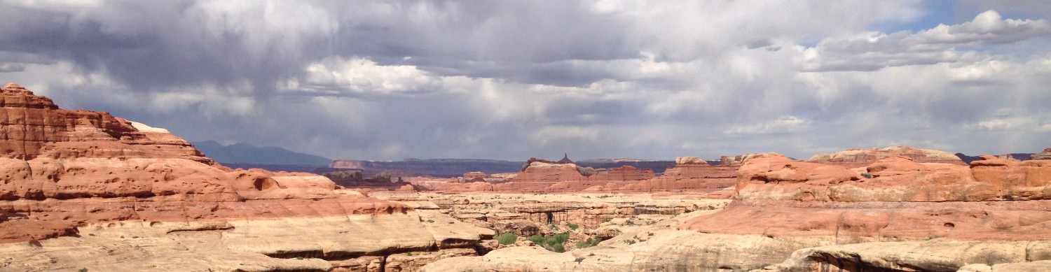
I climbed the rest of the way out of Hack Canyon, leaving the clearly striated rock of Grand Canyon country behind. Then it was roads roads roads, good walking roads that were softish dirt, but firm enough underfoot to not squander energy. It was cool when I started walking in the almost dark morning, and I noticed it stayed cool. Surprisingly cool. After 18 miles; around 10am, I stopped at the only water source for the day, a lined and fenced dirt impoundment fed by a piped spring. Still it stayed cool, so much so that I had to put warm clothes on. Inky dark clouds were building in towers to the north and west and the wind blew cold. Of all the days to receive such weather, there could not have been a more perfect day than this. Rather than scorching relentless sun the weather stayed overcast. I unpacked my bag at the water where I cooked my meal for the day and then lined my pack when I packed it back up, just in case the buising sky was going to actually burst. The rest of the day was beautiful, to my great delight and surprise. I’ve rarely enjoyed such a long road walk, but the grasses were mixed with flowers and subtle hues caught the eye: light greens, purple, oranges. The sky was full of complicated clouds, and I could see far away, even if there was nothing in particular to look at out there. More prairie, if that’s what to call this.
Around 4pm the clouds built into massive thunderheads that covered the sun and then released such a rain, a wind-driven singing rain like the clouds were dropping angry bees. Big fat ones. Thunder and lightning shook my senses, and I wondered if I should get low on this endless flat prairie, if lightning would be striking the ground soon. I didn’t stop though. I kept walking fast out of the last stretch of private property to BLM land and set up my tent in the wind and rain. By the time I had wrestled it up against the fierce wind, the rain had stopped, but I’m in a good place to make it into town tomorrow. I’m camped here behind a hill with the highway on the other side and I can hear the cars passing. The storm clouds come and go, but I’m cozy in my tiny tent. I ate some crackers and gummy bears, and I’m planning out my route for the last handful of days on the trail. Tomorrow I walk through Colorado City to resupply, and then it’s onward to Zion!


